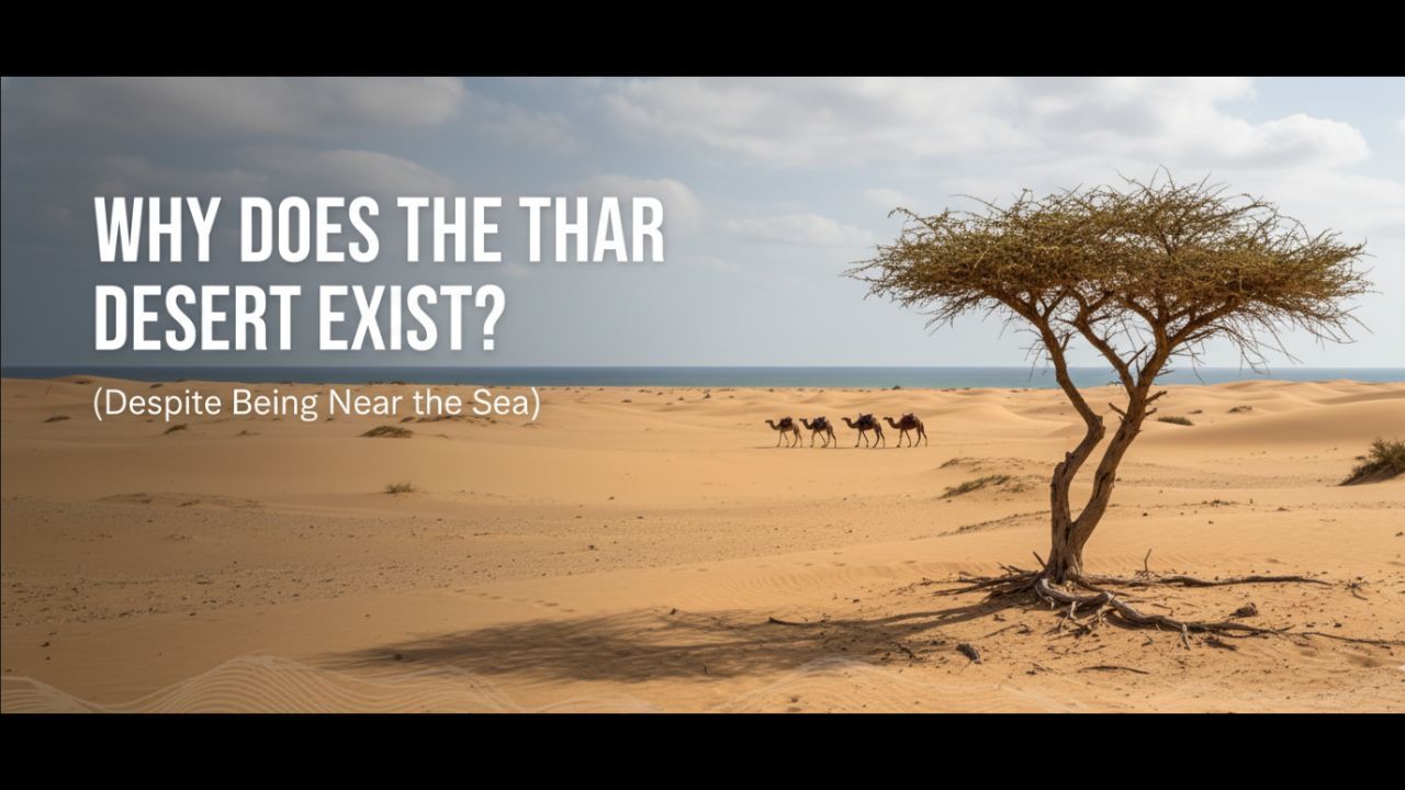
Why does the Thar Desert Exist? (Despite Being Near the Sea)
6 min read
Mar 11, 2026
Introduction
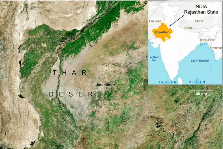
The Thar Desert, also known as the Great Indian Desert, is one of the largest hot deserts of Asia located in north-western India and eastern Pakistan. A striking geographical paradox associated with this desert is its proximity to the Arabian Sea, a major source of atmospheric moisture. Normally, regions close to oceans receive substantial rainfall due to moist maritime winds. However, the Thar Desert experiences extremely low rainfall and arid climatic conditions.
This phenomenon illustrates how topography, atmospheric circulation, and monsoon dynamics together shape regional climatic patterns. The Thar Desert therefore provides an important example of how physical geography influences climate distribution in the Indian subcontinent.
Geographical Location and Physical Characteristics
The Thar Desert forms the arid north-western margin of the Indian subcontinent, lying between the fertile Indo-Gangetic plains and the Indus basin.
- Located mainly in western Rajasthan with extensions into Gujarat, Punjab, and Haryana
- About 85% of the desert lies in India
- Covers an approximate area of 200,000 km²
- Characterised by sand dunes, saline depressions, and sparse vegetation
- Climate dominated by high temperatures and low rainfall
Key Physical Features of the Thar Desert
| Feature | Description |
|---|---|
| Total Area | Approx. 200,000 km² |
| Major Location | Rajasthan (India) and Sindh (Pakistan) |
| Average Rainfall | 100–300 mm annually |
| Temperature | Summer up to 48°C |
| Major Landforms | Sand dunes, interdunal plains, saline lakes |
The geographical location of the Thar Desert places it in a region where monsoon dynamics and topography strongly influence rainfall distribution.
Failure of the Arabian Sea Branch of the Monsoon
The south-west monsoon winds are the primary source of rainfall for most parts of India. However, their influence weakens significantly over the Thar region.
- The Arabian Sea branch of the monsoon first strikes the Western Ghats
- Heavy rainfall occurs on the windward side of the Western Ghats
- Much of the moisture is lost before the winds move northwards
- By the time these winds reach Rajasthan, they become relatively dry
This results in limited rainfall in the Thar Desert despite the nearby Arabian Sea.
Orientation of the Aravalli Range
The Aravalli Range plays a crucial role in the climatic conditions of north-western India.
Unlike many mountain ranges that block moisture-laden winds, the Aravallis do not effectively intercept the monsoon winds.
- The Aravalli Range runs south-west to north-east
- Monsoon winds travel parallel to this range
- As a result, the winds do not rise to produce orographic rainfall
- Lack of uplift prevents significant cloud formation
Influence of Major Mountain Ranges on Rainfall
| Mountain Range | Orientation | Effect on Rainfall |
|---|---|---|
| Western Ghats | Perpendicular to monsoon winds | Heavy orographic rainfall |
| Himalayas | East–west barrier | Prevents monsoon escape northward |
| Aravalli Range | Parallel to monsoon winds | Very little rainfall |
Thus, the parallel alignment of the Aravallis is a major factor behind desert conditions in the region.
Weak Influence of the Bay of Bengal Branch
The Bay of Bengal branch of the monsoon carries significant moisture but mainly affects eastern and northern India.
- Moist winds move north-westwards along the Indo-Gangetic plains
- Maximum rainfall occurs in eastern India and Himalayan foothills
- As the winds travel westwards, their moisture gradually decreases
- By the time they reach Rajasthan, very little moisture remains
Consequently, the Thar Desert remains largely outside the primary rainfall zone of both monsoon branches.
Subtropical High Pressure and Descending Air
The Thar Desert lies close to the subtropical high-pressure belt, which influences atmospheric circulation.
- Regions around 20°–30° latitude experience descending air masses
- Descending air becomes dry and warm
- Dry air suppresses cloud formation and precipitation
- This leads to clear skies and arid climatic conditions
These atmospheric dynamics reinforce the desert climate of north-western India.
High Temperature and Evaporation
Climatic conditions in the Thar Desert are characterised by extreme heat and strong evaporation.
- Summer temperatures often exceed 45–48°C
- Intense solar radiation increases evaporation rates
- Moisture evaporates rapidly from the surface
- Evaporation exceeds the limited rainfall received
Climatic Characteristics of the Thar Desert
| Parameter | Condition |
|---|---|
| Rainfall | Very low (100–300 mm) |
| Temperature | Extremely high in summer |
| Evaporation | Very high |
| Vegetation | Sparse xerophytic plants |
This imbalance between precipitation and evaporation sustains desert conditions.
Lack of Perennial Rivers
The Thar Desert also lacks major perennial river systems, which further intensifies aridity.
- Most rivers in the region are seasonal or ephemeral
- The Luni River is the only significant river but flows mainly during the monsoon
- Many drainage basins are inland and do not reach the sea
- Groundwater is often saline or brackish
Important saline lakes in the region include:
- Sambhar Lake
- Didwana Lake
- Pachpadra Lake
Limited water availability prevents the development of dense vegetation and agriculture.
Major Factors Responsible for the Thar Desert
| Factor | Geographical Impact |
|---|---|
| Weak Arabian Sea monsoon | Limited rainfall |
| Orientation of Aravalli Range | No orographic uplift |
| Weak Bay of Bengal influence | Moisture loss before reaching region |
| Subtropical high pressure | Descending dry air |
| High evaporation | Moisture loss exceeds rainfall |
| Lack of perennial rivers | Water scarcity |
These combined factors explain the persistence of the Thar Desert despite its proximity to the Arabian Sea.
Conclusion
The existence of the Thar Desert near a major moisture source demonstrates the complex interaction between monsoon circulation, topography, and regional climatic processes. The parallel orientation of the Aravalli Range, weakening of monsoon winds, subtropical high-pressure conditions, high evaporation, and absence of perennial rivers collectively create arid conditions in north-western India.
The Thar Desert therefore illustrates how physical geography and atmospheric dynamics together determine the spatial distribution of deserts, even in regions located close to large water bodies.
FAQ
Why is the Thar Desert so dry despite being near the Arabian Sea?
The Arabian Sea branch of the southwest monsoon loses most of its moisture over the Western Ghats before reaching the desert, leaving dry winds by the time they arrive in Rajasthan.
How does the Aravalli Range affect rainfall in the Thar?
The range runs parallel (southwest-northeast) to the monsoon winds, so they flow alongside it without rising over it to create orographic rainfall unlike the perpendicular Western Ghats.
What role do subtropical highs play in the Thar Desert's climate?
Located near 20°–30° latitude, the region falls under descending dry air from subtropical high-pressure belts, which warms up, suppresses clouds, and prevents precipitation.
Why don't both monsoon branches bring rain to the Thar?
The Arabian Sea branch dries out early, while the Bay of Bengal branch loses moisture traveling northwest over the Indo-Gangetic plains, delivering little by Rajasthan.
Do any rivers help reduce aridity in the Thar Desert?
No rivers like the Luni are mostly seasonal, drainage is inland, and groundwater is saline, worsening water scarcity alongside high evaporation rates.
Questions
- Why does the Thar Desert receive very little rainfall despite being close to the Arabian Sea?
- How does the orientation of the Aravalli Range influence rainfall distribution in north-western India?
- Why do the monsoon winds fail to produce significant rainfall in Rajasthan?
- What role does atmospheric circulation play in the formation of the Thar Desert?
- How do topography and monsoon dynamics together shape desert climates?
Takeaways
- The Thar Desert is created by a combination of climatic and topographical factors.
- The Arabian Sea monsoon loses moisture before reaching Rajasthan.
- The Aravalli Range runs parallel to monsoon winds, preventing orographic rainfall.
- Subtropical high-pressure conditions cause descending dry air.
- High evaporation and lack of perennial rivers reinforce arid conditions.
You will also like: Indian Geography